|
First Municipalities
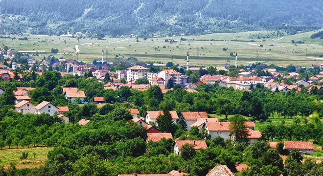
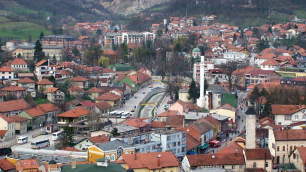
Bosanski Petrovac
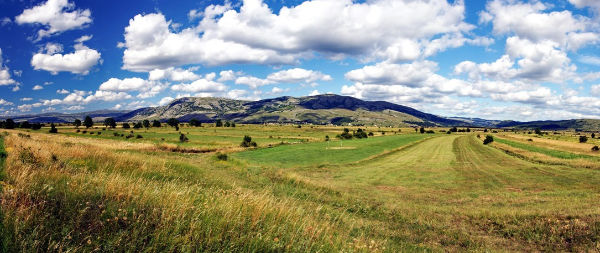
General Information The municipality of Bosanski Petrovac is located in the North-Western part of Bosnia and Herzegovina, within Unsko-Sanski Canton of the Federation BiH. The municipality spreads over 716, 52 km2 of agricultural and forestry land (36, 39% agricultural and 63, 61% forestry). The municipality is located at an altitude of 669 m, near the towns Ključ, Bihać and Drvar.
The climate is moderate continental, influenced by the altitude. Temperature ranges from +20°C to -22°C, with the average temperature in January and December between +2°C and -2°C. Average annual precipitation is around 1200 mm, with monthly settling varying between 90 mm in February and 150 mm in November. Annual snow coverage is 40 to 60 days, while mountain grounds are usually covered with snow for up to 90 days.
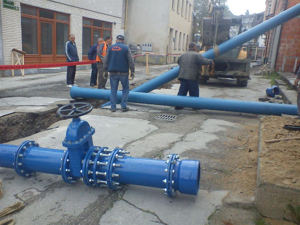
According to the population census conducted before the war in 1991, the municipality had 15 600 citizens. Currently, the whole area is populated with around 8000 people. Economic activities are closely linked with natural forest resources and agricultural land mainly satisfying needs for development of farming and partially agricultural cultivation flourishing in the existent climate conditions. The municipality has recently initiated activities on physical construction of business and industrial zones at locations with well-developed communal infrastructure. Technical Data Water Supply Water Supply System of the urban part of the municipality dates back to 1904, when the System Smoljana was constructed. The system currently functions with two sources of supply, namely the Gravity System – Smoljana (group of springs – Grmeč - 930m altitude) located 12 km away from the town, and System Sanica (overtake at the spring of Sanica is located at 221m altitude – a pumping system with the elevation capacity of 710m and installed pumps with 2 x 710 KWh motor power). The pipeline is 3125m long, with the gravity transition pipeline in the length of 28 km. The system was constructed between 1984 and 1991. Chlorination stations were built within the reservoir Novakovići - v = 2x100 m3, h = 729m altitude - System Smoljana, and the reservoir Bursaći - v = 2000 m3h = 719m altitude – System Sanica (Gas Chlorinators). Electromagnetic devices for measuring the water flow are installed in each reservoir.
Distribution System covers urban part of the city and surrounding settlements, with extension to the settlements Suvaja, Medeno Polje, Bjelajski Vaganac, and the Local Community of Kolunić, constructed between 2001 and 2007. The system is gravitational, except for the higher zones of the water supply System – LC Kolunić with installed pressure pumps. Between 1997 and 1999 distribution network of the town was reconstructed with DN150-DN400 mm profiles distribution rings. Sewerage Sewerage Network currently covers around 30% of the urban municipal part, the rest of the waste water system consists of leaking septic tanks. The system is gravitational – combined with direct discharge without any treatment into the natural recipient underground stream Japaga. The underground stream Japaga belongs to the watershed of the river Una with all the waste water ending via underground streams in Unac.
Municipal Scheme Data (Ongoing and Planned Construction Works) Water Supply Planned activities include implementation of projects related to partial reconstruction of the distribution network in the settlements and streets Dževar-Dobro selo, Ploča, Bahići, Revenik, Ulica 14. septembra (14 September Street), Ulica 5. Korpusa (5 Corps Street), and development of the systems directed to the Industrial Zone Gorinčani and settlements along the route. Additionally, special emphasis was placed on the activities on detection and reparation of damages, increase of metering levels for both extracted and distributed water (instalment of flow metering devices, water and pressure metering devices in collective residence buildings etc.). Reparation of the Telemetric Supervision and Control System and Chlorination Stations equipment is envisaged as well.
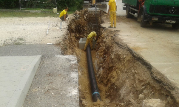
Sewerage Ongoing activities include preparation of the overall reconstruction and construction of the Bosanski Petrovac Sewerage Network Project implementation – Phase I, with construction of the Waste Water Treatment Plant (WWTP) as priority case (closed financial construction for the Phase I, with developed Main Design and Environmental Study). Activities on the preparation of Tender Documents are ongoing. Bosanska Krupa
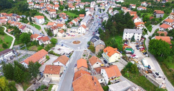
General Data The municipality of Bosanska Krupa is one of the eight Unsko – Sanski Canton municipalities of the Federation BiH. Bosanska Krupa is located in the North-Western part of Bosnia and Herzegovina at 44° 53' 6'' northern latitude and 16° 9' 31'' eastern longitude, with the average elevation of 177 m. The municipality spreads over 561 km² of wide area by the Valley of Una River, between the mountain of Grmeč in the South and state border of Republic Croatia in the North. Through nearby traffic junctions the municipality is connected with the Western and Southern Europe.
Technical Data Water Supply Water Supply within the area of Bosanska Krupa municipality is secured through several water streams' overtakes, with Luke and Ada being the most significant ones, supplying around 60% of the municipal population. Average capacity of these streams is 102 l/sec.
Water source Luke consists of two exploitation wells located at the left bank of the river Una within the urban settlement Luke. Water is pumped from these wells and transferred into the 350 m3 capacity reservoir Tećija and distributed through a gravitational system and water supply pipes into the network for the left river bank part of the City. With the average water intake of 24 l/sec being enough for app 6.500 citizens there are no interruptions of distribution. Most significant problem for this high quality water source is close location of several potential pollutants positioned within the first wells protection zones. Water source Ada consists of four exploitation wells. Water from these wells is pumped and transferred into the 2000 m3 capacity city reservoir Hum and then distributed through a gravitational system into urban water supply network for the right bank river part of the city. The average of water taken from these wells is 78 l/sec. Water from the source Ada is also used for supply system of the settlement Bosanska Otoka and nearby communities. Wells used for this water source are located on a small isle on the right Una river bank, which is not permanently populated, but located in close vicinity of several sport facilities and agricultural land, all of which are potential pollutants.
Sewerage network Sewerage system of Bosanska Krupa consists of collectors, natural decline system, pumping station and supply line with existent mixed sewerage system constructed in the period between 1970 and 1990. Waste water is dischearged without any treatment directly into the recipient rivers Una and Krušnica (a tributary of the river Una), upstream of the main water source. Existent sewerage network is generally in poor condition and mainly consists of concrete sewerage pipelines and DN 200-1000 mm collectors. Around 30% of population from urban municipal areas are connected to combined sanitation system. 45% of the population use septic tanks while 25% of people directly discharge waste water into rivers. Most of the septic tanks used are not designed in technically sufficient manor. Almost all surface water collected from public areas are connected to urban waste water collectors. All waste waters are being directly discharged into the recipients without any prior treatment. Municipal Scheme Data (Ongoing and Planned Construction Works) Water Supply Within the municipality of Bosanska Krupa there is currently one water supply project with on-going works, namely water supply project for local communities Mahmić selo, Pištaline and Jezerski. Following the finalization of project documentation development for water supply of willages under the mountain Grmeč, works will also be initiated on the municipal water supply facilities and primary secondary network project. Finalization of these two WS projects will secure public system water supply for more than 90% of Bosanska Krupa population.
Sewerage With regard to municipal sewerage system, works are currently on-going on the Phase IV of Water Stream Kalender Regulation, being implemented through project GOV WADE, as part of the overall sanitation scheme in the city of Bosanska Krupa. After development of respective
Široki Brijeg
General information Municipality of Široki Brijeg is located in the central part of Western Herzegovina and belongs to the Canton 8 of the Federation BiH, namely West Herzegovina County, representing its administrative, economic and cultural centre. Široki Brijeg is a medium size municipality occupying the area of 388 km2 with the altitude of 275m in the city centre. According to the census of 1991 the municipality used to have 27 189 inhabitants and now pursuant to overall statistical data the number of municipal population is around 30 000. Population density within the municipality is 77 people per km2. Široki Brijeg is positioned mainly within a high karst zone, with all the characteristic karst forms, truncated spurs of torrential water-streams and karst fields. Municipal area is under the influence of Mediterranean arid climate with short rainy winters and long dry summer periods but with significant influence of continental climate as well, particularly during the winter in northern parts. Amount of annual rainfall is about 1600 mm. Precipitation is lowest in July and August (50-80 mm m.) and highest in December (255 mm). August is the hottest month with an average temperature of 21.7 ° C, while the coldest one is January (- 1.4 ° C). Average annual temperature is 11.5°C. Široki Brijeg is the most economically developed municipality in West Herzegovina County. It is one of the most developed municipalities in Herzegovina and among medium developed municipalities in Bosnia-Herzegovina. Starting from the last decade of previous century private business within the municipality has been in rapid growth. With increased number of trade companies, major municipal business entities and at the same time holders of municipal economic development are the companies from metal-processing, meat industry and construction, with significant level of craft and other independent business entities. The number of persons in work is around 6200, with over 3500 unemployed persons. Employment rate is slightly higher than the average in FBiH. Gross Domestic Product (GDP) is at the average level in FBiH (5000 KM).
Technical Data Water Supply Water Supply System of Široki Brijeg covers the larger part of urban and part of suburban municipal settlements. Water intake facility is located at the wellspring of the river Lištica being the point from which the water is being gravitationally transferred to the main pumping station and then taken through the pressure system onto the central Water Tank. From the water tank, the water is gravitationally distributed to the costumers. It is in the Pumping Station where the water chlorination is carried out. Construction of the water supply system was initiated in the 1930s, with extension and reconstruction works being still in progress. However, these works are not part of the WATSAN FBiH.
Sewerage System Sewerage system of Široki Brijeg is designed as a dividing system. Five collector zones have been designed namely as Collectors A, B, C, D and E. Total length of all waste water collectors is 61 339 m with 250 to 500 mm diameter faecal transition mains. Faecal waste water is transferred to the Waste Water Treatment Plant located downstream of the City at the lowest point within the whole system providing for a natural descend Sanitation. Storm water is taken to the recipients (Lištica and Urgovača rivers) with prior treatment conducted by grease separators which are not subject of the WATSAN FBiH Project. The exact location of these recipients will be determined within Main Design. Since the sewerage collectors' route runs through the densest populated municipal area actual construction works will have to include all other necessary segments (driveways, pavements, relocation of plumbing etc.). This project is therefore to include construction of the remaining parts of the Collectors A and B, Collector C, and priority parts of Collectors D and E. Treatment of municipal wastewater is planned to be done through a central Waste Water Treatment Plant in the capacity of 10,000 PE. The Plant is to be constructed using „turn-key“ system with Loan Funds of the Kingdom of Spain in the amount of € 1.8 million. This is not subject of the WATSAN FBiH Project. Recipient of the Plants' treated water is River Lištica downstream of the City. Recipients of storm water are Rivers Lištica and Ugrovača at the predesigned locations.
Municipal Scheme Data (Ongoing and Planned Construction Works) Sewerage System: The project envisages construction of the Sewerage Collectors system, namely: 1. Collector B - phase I
Tomislavgrad
General information The municipality of Tomislavgrad is located within the South-Western part of Bosnia and Herzegovina, in the Herzeg-Bosnian Canton. It lays at the altitude of 900 m, covering the area of 967 km2. Neighbouring municipalities of Tomislavgrad municipality are Kupres, Livno, Jablanica and Posušje. Mediterranean, continental and mountain climate all meet and interact within municipal territory, resulting in sometimes sharp and idyllic winters, with pleasant and moderately warm summers. The number of sunny and windy days is almost equal. Tomislavgrad municipality is located in the geological zone of rubble and its entire territory belongs to the river Cetina basin. Results of municipal climatic characteristics analysis brings out conclusion about rich water resources. Calculating the average rainfall in the catchment area of about 1200 mm results with each km2 of the basin having more than 1.2 million m3 of water during an average year. However, conditions for use and protection of water are extremely unfavourable and difficult because most of total annual rainfall occurs within very short winter period and due to specific geological conditions, with karst prevailing in the highest part of the Duvno field, water is not retained but practically directly descends towards lower horizons, creating considerably difficult conditions for water operation and distribution. According to the census of 1991, 30.009 inhabitants used to live in the municipality of Tomislavgrad, while today by some estimates this municipality is populated with approximately 27.000 inhabitants. Within the economy structure, widespread activities are trade, catering, and various craft activities. The basis of municipal economy is production, and largest municipal producer is the Cable Factory Kapis. Significant presence within municipal economy is the one of Wood Industry, which currently offers production of sawn timber without the final product. Production of building materials (blocks, gravel, sand) and food industry should also be mentioned.
Technical Data Water supply According to the study conducted, Water Supply Situation in the municipality of Tomislavgrad is such that a lot of pipeline is damaged, with excessive repairs per meter, indicating bad materials (ACC tube) used and poor quality of the actual pipeline construction. Amount of un-revenue water (illegal connections) is enormous, resulting with low quality and insufficient amounts of drinking water during summer months due to penetration of water from surrounding terrain into the pipeline. Costs of electricity consumption for 1m3 of invoiced drinking water are also very high. One of the municipal priorities is providing for the arrangement along which all municipal settlements would receive water from public water supply. To this end, aiming to realize this goal, municipality Tomislavgrad has invested significant resources within the previous period. In the final stage of the water supply system "Josip Jović", supplying the area around Buško Lake with drinking water. To date, already 95% of this area population has resolved the issue of water supply. In early 2004, pumping station "Letka" was constructed on the water supply system "Duvanjsko field" as the initial facility of the sub-system "Letka". Similarly, the municipality continued with construction of the primary pipeline following the Main Design. There are 600 households currently connected to this subsystem. Sewerage system In order to gradually solve the unsustainable status quo, Tomislavgrad is to start preparing the project documentation for the construction of sewage and then works in phases. Project documentation was developed in 1982, and during 1990 and 1991, work started on the work. L was constructed around Km. the city's main collector. The work was funded by the municipality Tomislavgrad and the Republic Fund for Water Management. During 1997 and 1998, was built in 1 km main collector of the municipality and the Public Water Management Company Mostar. To project wastewater treatment facility is planned to draft the terms of reference for the conceptual design of a device for wastewater treatment capacity 7.850ES, a major project Device for treatment will be performed as part of the development of the device for treatment.
Municipal Scheme Data (Ongoing and Planned Construction Works) Water supply
1. Location and shutting down illegal connections
Sewerage system
1. Main sewerage collectors
Velika Kladuša
General information Velika Kladusa is the city and center of the municipality in the far northwest of Bosnia and Herzegovina. It is one of the eight municipalities of the Una-Sana County. According to the basic natural-geographical characteristics, the area of Velika Kladuša belongs to the Peripanon area, located between the Dinaric mountains in the southwest and the low Posavina in the north, with an average altitude of 300 to 400 m. Karstic relief forms are seen in a considerable number of sinkholes, abysses and caves still unexplored. The area of the municipality belongs entirely to the Glina River Basin, a tributary of the Kupa River, open to the north through the valleys of the rivers Kladušnica and Glinica. The municipality is extremely rich in preserved natural sources of drinking water, as well as with sources of thermal water that can be used for health and recreational purposes. Its main climatic characteristics lie in a temperate continental climate characterized by moderate warm summers with an average annual temperature of 10.3 degrees Celsius and moderately cold winters. In 1991, the municipality had 52,908 inhabitants, as the area of the municipality is 331.55 km2, this municipality is included in the most densely populated areas of Bosnia and Herzegovina. It is estimated that the municipality now has about 44,350 inhabitants. The land of Velika Kladuša municipality is one of the most important factors in municipal development in terms of geographical position, climatic and hydrological conditions, geological and pedological characteristics. The largest percentage of total municipal land area goes to agricultural land - 22,375 ha or 67.48% of the total area.
Technical data Sewerage network
Municipal Scheme Data (Ongoing and Planned Construction Works)
Orašje General information The municipality of Orašje is located within the Posavina Canton in the north of Bosnia and Herzegovina. Situated along the Sava River with the average altitude of about 85m, Orašje is one of the smallest municipalities in the Federation BiH, with total area of 122 km2. The municipality consists of 13 settlements, one of which is urban and all other ones rural. One of the main border crossings, connecting BiH with the Republic of Croatia and the rest of Europe, is located in the area of the municipality, which ensures a good communication connection with all parts of Bosnia and Herzegovina, as well as with the neighbouring countries, because it is only 12 km away from the Zagreb - Belgrade highway. Before the war, the municipality of Orašje used to have 26,000 inhabitants and had strong established agriculture and industry mainly related to tobacco cultivation and processing, including mechanization. As a consequence of the war and transition process, the number of inhabitants and industrial activity are significantly reduced, therefore the Statistical Review of the FBiH in 2007 lists the number of inhabitants of 22 532. In the post-war period, agricultural production became the main segment of maintaining regional economic development and makes up to 80% of total activity.
Technical data Water supply
The whole network is supplied gravitationally from the raised storage in Kostrč, which is filled from the neighbouring pump. There are no formal zones, but the main distribution system is divided in the way that the flow to Orašje is separated from the feed for nearby villages in the south of the area. The network is expanded by ring networks for each major village. The secondary main distribution lines are built to match the property in the streets away from the primary network.
Sewerage network The wastewater system in the municipality of Orašje consists of a partly combined drainage system in the city of Orašje and, in general, septic tanks in other areas. Many of the septic tanks are not watertight and work somewhat as suction pits, while in some cases waste water is discharged directly into small rivers or drainage channels. The original sewerage system in Orašje was designed as a combined system and built in 1984. The main collector 1, with discharge into the Sava River, is about 2 km long and is constructed of asbestos cement tubes in the diameter of 500 to 900 mm. The pipes are set rising from 1.5 to 1.8 ° which allows gravity release, except during the highest water level of the river. Collector 2 is approximately 860 meters long with 500 mm in diameter. There is no treatment of wastewater within the municipality of Orašje, but potential location for the Waste Water Treatment Plant has been identified (not purchased), near the river pumping station.
Municipal Scheme Data (Ongoing and Planned Construction Works) The overall objective of the project is to improve water supply and waste water drainage in Orašje municipality by improving the quality of drinking water, expanding the network of water supply and wastewater networks, and by building an urban waste water treatment plant (WWTP). Implementation of the project is expected to provide significant positive impact on public health, improve quality of life, and contribute to further development of Orašje municipality, together with meeting general needs in relation to future compliance with the EU Law on Environment. It is estimated that 10,000 inhabitants will directly and 25,000 indirectly benefit from the WATSAN FBiH municipal Scheme of Orašje.
Mostar
General information The City of Mostar is located in the Herzegovina Neretva Canton of the Federation BiH and represents the regional canter of Herzegovina. Located at 43º 21’ Latitude N and 17 º 49’ Longitude E, with an average altitude of 99m, it extends to 139, 50 km2. Mostar’s neighbouring cities are Jablanica, Čapljina, Stolac and Čitluk. According to estimates of the Federal Bureau of Statistics, as of June 30, 2011, the City of Mostar (from Žitomislić to Drežnica) is populated with 111,364 inhabitants and is the largest inhabited place in the Herzegovina Neretva Canton.
Technical data
Water supply Water supply of the City of Mostar is provided from several water sources, of which the most important sourced are Vrelo Radobolje, Studenac and the source Bošnjaci. Capacity of the existing water sources can meet overall needs of the city and suburban settlements, but the actual state, capacity and insufficiency of the water supply network prevent appropriate water supply throughout the whole city. Water quality is at satisfactory level, but the main problem is old and detoreated water supply network, which is causing large losses in distribution. Water distribution system is combined (gravity and pumping) and is in poor condition.
Sewage Before implementation of the Project WATSAN FBiH, the city sewage and drainage systems were in even worse condition (asbestos - cement, concrete pipes - mostly) than the one of the water supply, and therefore certain remediation, modifications and expansion of the network were needed for all suburban settlements, since there was no sufficient built-up sewage system. Main problem was the large number of septic tanks (with a watertight bottom) which are constantly causing increase in pollution of groundwater. Only certain parts of the city have got their own local collectors. Prior to the project of the city waste water treatment plant construction there was no wastewater treatment whatsoever present within the sewage system of the City of Mostar, and before construction of the plant waste water from about 50 km of existent sewage network was being discharged directly into the Neretva River at about 30 separate locations.
Municipal Scheme Data (Current and planned construction works) Representatives of the City of Mostar have developed their Project Fiche for implementation of the project WATSAN FBiH as part of their efforts to secure € 8 000 000 of EIB funding for construction of the sewage system Phase 1 in the city. The Phase 1 consists of several sewage collectors on both banks of the Neretva River. Estimated total cost of the Phase 1 is € 16.096 M including the total new investment € 11.796 M.
Usora General information: Municipality of Usora is the northernmost municipality in the Zenica-Doboj Canton of the Federation BiH. It is positioned at 44º 41' 55'' of northern latitude and 17º 58' 33'' of eastern longitude, with the altitude varying between 150 and 330m. Usora is one of the twelve municipalities of the Zenica-Doboj Canton, Usora’s neighbouring municipalities are Tešanj, Doboj Jug and Doboj, while the nearby towns are Tesanj (15 km to the South), Teslić (15 km to the South-west), Doboj Jug (8 km to the East) and Doboj (15 km, to the North-east). Geographical area of the municipality covers 49.8 km2. According to the 1991 census, Usora used to have 8,894 inhabitants while according to certain statistical estimates, there are 7,700 inhabitants living in the municipality now. Municipality of Usora with its surroundings is positioned in the moderate continental climate zone whose influence is felt through the valley of the Bosna River coming from the Pannonian Plain. Quite sharp winters and warm summers are basic characteristics of this climate but in comparison with the alpine zone variations between winter and summer temperatures are smaller. Lowest temperatures are in January and highest in July. Along with favourable geo-communicational position and good potential for future economic development, major natural resources of the municipality Usora are arable land (3.510 ha) specifically suitable for farming, river Usora with its hydro and fishing potential, as well as hardwood and softwood forests. Overall agricultural land within the municipality spreads over 3.614 ha. Entire municipal area is covered by public water supply network service. Protection of natural resources and environment is ensured through implementation of environmental regulations and inspections procedures together with organized garbage collection which is a joint responsibility of local households and business entities.
Technical data Water supply Existing water supply system in Usora municipality consists of 5 individual systems through which some 85% of municipal citizens are connected to the public water supply. Water supply network is about 72 km long and is servicing 421.580 m3 of water on annual base. About 337.260 m3 of this water per year is discharged as waste water into the surroundings. Plumbing facilities were constructed during the period of previous 15 years and are in good condition. Projects for protection of water sources are already developed and need appropriate investment funds for implementation of protection measures. Water distribution system functions with the water being pumped from the source or pumping station through pipeline and then transferred to the water tank facilities and gravitationally distributed to the customers with pressure pipeline in Žabljak being also used as a distribution line, which is the component planned for modification with construction of a separate supply line. There are 12 wells/springs built within 5 (five) spring locations, with constructed 7 (seven) 1050 m3 water tanks/reservoirs. Water supply system in the village of Žabljak, where the municipal sub-project for sewerage system construction will be implemented, consists of 4 wells installed with 7-11 KW pumping stations, 150 m3 water tanks and distribution network in the length of 4,500 meters. Chlorination of water is conducted within the pumping station.
Sewerage system Main components of the municipal sewerage system are collectors, a natural fall system, pumping stations and supply pipeline. Treatment of municipal wastewaters has not been conducted so far but is planned along the construction of wastewater treatment plant during the phase II of municipal scheme. This waste water treatment plant will have the capacity of 1500 PE with estimated investment cost of around € 350,000. Aiming to resolve the current unsustainable situation and provide for protection of the drinking water source and prevention of the air and soil pollution, the municipality of Usora and public community Žabljak have initiated the procedure for development of project documentation for construction of the sewage system which was followed with phasing the respective construction works. Municipal sewerage network was built in the length of 0.56 km and is not connected to the recipient.
Municipal Scheme Data (On-going and planned construction works) Due to the actual unfavourable situation in the area of waste waters the municipality of Usora has nominated its scheme "Sewerage System Žabljak (loc Kanalizacija Žabljak)" to be implemented through the Project WATASAN FBiH. Primary goal of the scheme is to resolve the evident waste waters issues within the populated lowland municipal area and protect the drinking water source. As the project documentation was developed in 2004, in order to protect the water source and increase the scope of sewerage network, extensions on the network must be made including designing of both sewerage collectors and wastewater treatment plant (WWTP). As financial construction of the WWTP is not closed as yet the plant will be implemented within the second phase of the scheme. Parts of the sewerage system to be built during the phase I include five collectors in the total length of 7,140 m. These collectors will function as gravity system collectors partially combined, with rainwater drainage (rainwater from the buildings) planned for washing the collectors due to the minimal extended fall.
Components of the Scheme "Sewerage System Žabljak" 1. Designs for extension of the collector network and WWTP and revision of the project documentation 2. Construction of the primary network of collectors (already designed) 3. Construction works on extension of the Collector 4 4. Construction works on the Collector 5 5. Extension of the collectors leading to the WWTP 6. Supervision cost.
Doboj Jug
General Data Municipality Doboj Jug is located within Zenica-Doboj Canton of the Federation of Bosnia and Herzegovina, at 18o 03' 06'' of eastern longitude and 44o 41' 16'' of northern latitude, covering the area of 10.2 km2. Municipality of Doboj Jug is located at the confluence of Usora to the Bosnia River which is the largest tributary of the Sava River in Bosnia. Elevation is mostly between 150-250m. Neighbouring cities are Doboj (80 km to the North), Usora (to the North West), Petrovo (to the South East), and Tešanj (5 km to the South). The municipality of Doboj Jug is mostly characterized with very hot summers, moderate cold winters, and autumns longer than springs. The warmest month is July and coldest one is January. Annual precipitation is around 970mm/m2. The municipality of Doboj Jug is one of the new municipalities in BiH. Advantage of the municipality in comparison with others is represented with well-organized transportation lines. The municipality currently has 5.000 citizens living in settlements Matuzići and Mravići. According to the census from 1991, belonging to the municipality of Doboj, before the war the two settlements had 3.259 citizen. Population density in the municipality of Doboj Jug is around 500 citizens per km2. This value is pretty high in relation to the population density of the Zenica-Doboj Canton (120/km2) and population density of the FBiH (89/km2). Technical Data 
Water Supply 96% of the municipality population is connected to the public Water Supply System. Around 50 households in the municipality of Tešanj (around 200 citizens) uses water through the public Water Supply System of Doboj Jug. Water Supply of the municipality Doboj Jug is secured through the water from the river Bosna. Municipal Water Supply System consists of three wells with the total capacity of 30 l/s, 6 water reservoirs (2 for pressure control), 3 pumping stations (PS), 8,4 km transition main and around 35 km of distribution network. There are no Potable Water Treatment Facilities within the municipality. Water taken from the wells is being chlorinated at the source before distribution and the chlorine is being measured in the reservoirs. Water Quality Analysis is being conducted on monthly basis by the Public Health Institute of the Zenica-Doboj Canton and the quality mostly fulfils requirements of the Regulation on Potable Water Sanitation Conditions Standards (SFRJ Official Gazette, no. 33/87). Generally there are no large problems with servicing, however in the summer season amounts of water taken from the sources are not enough to serve the whole area. The municipality of Doboj Jug uses SCADA system connected to all water supply facilities at seven locations. Experts of the Public Utility Company conduct monitoring of the whole water supply service process and strive to identify problems and observe remaining chlorine within tanks through the SCADA System. Although total losses in the water supply system are not too high (27%), most losses are caused by cracks on asbestos-cement transmission pipes that are old and deteriorated and as such present the oldest elements within the system. 
Sewerage Collection system for the Sanitation services is only partially established. According to the data from the municipal development strategy approximately 30% of population within the existing Sanitation System uses individual septic tanks while the rest households discharge their waste water directly into neighbouring water streams, channels etc. Large scale design has been developed for construction of the primary sewerage collectors for the area of the whole municipality. Construction of the waste water collection system was initiated in 2006 and the preliminary design of this segment is finalized. The municipality has also initiated construction of the sewerage system and so far around 5, 5 km of 28 km sewerage network designed in total were constructed (mainly collectors). Existing design does not cover secondary and tertiary collector network. Based upon data from the Public Utility Company, 26 industrial companies are connected to the sewerage system, with all the remaining ones planned to be connected in the future. Main problems within the waste water treatment system concern the low level of the network connection and connection to the collector. Although 20% of the designed system have been constructed, only 8% of the population is connected to the Public System, which indicates to the low level of public awareness about the importance of waste water as well as the service stated within the development strategy. Low connection level has negative effect to the appropriate sustainability of the system. Collected incomes funds can not cover the whole costs system. Municipal Sewerage System consists of two separate collectors, however the storm and waste water collectors are not separated. Sewerage System has got natural slope without existence of pumping stations. There are no Waste Water Treatment facilities within the municipality. All waste water are being collected and discharged directly into the river Usora without any treatment and there are no waste water pumping stations as well. Municipal Scheme Data (Ongoing and Planned Construction Works) Water Supply Considering the existent situation within the system, there are no ongoing projects and the following projects have been planned: Sewerage Implementation of the following two projects related to the waste water treatment have been planned:• Construction of the secondary sewerage collectors in the area of Novo Naselje and construction of the primary collector No 2; • Construction of additional part of the primary collector No 3. 
Planned projects • Extension of the sewerage system to cover 80% of the population;• Construction of the storm water drainage system to cover 50% of the municipal area; • Construction of the WWTP second phase after connection of the settlements Šije (municipality Tešanj) on to the sewerage system of the municipality Doboj Jug. 
|
New Municipalities
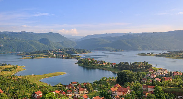
Jajce General information The municipality of Jajce is located in the central part of Bosnia and Herzegovina (BiH), within western part of the Central Bosnia Canton, at 40º 20' 30" of northern latitude and 17º 14' 16" of eastern latitude. The municipality spreads over the area of 363 km² and borders with the municipalities of Travnik, Dobretići and Donji Vakuf from the Central Bosnia Canton, and the municipalities of Jezero, Šipovo and Mrkonjić Grad from Republika Srpska (RS). Municipal area is characterized by mountainous terrain, with altitude ranging between 350 m (the waterfall) and 1,400 m (Suhi Vrh peak). Territory of the municipality is consolidated around the river Vrbas and its left tributary Pliva, with Veliko Plivsko Lake and Malo Plivsko Lake located 5 km away from Jajce city centre. Climate of municipal territory is moderately continental, with warm summers and sharp and snowy winters. The average air temperature in July is l8 ° C, and in January l, 8 ° C. 
According to the population census of 1991, the municipality used to have 45,007 inhabitants. During and after the war significant changes occurred within municipal demographic structure and according to estimated data of the Federal Bureau of Statistics for 2010, Jajce currently has 24,383 inhabitants. Overall economy of Jajce municipality is based on metal industry, wood industry, production of electricity and mining. Municipal forestry area covers some 20,978 ha or 54% of total municipal territory. There are several mineral and ore deposits as well including bauxite sites around areas Poljane and Bešpelj. In the near vicinity of urban area there are several deposits of non-metallic materials suitable for construction. The river Pliva with its lakes and waterfalls, together with rich cultural and historical municipal heritage, represent unique tourist attractions of Jajce municipality. Municipal economy is mainly export oriented. 
Tehnički podaci Technical data Together with one part of surrounding settlements, water supply of Jajce municipality is serviced mostly from the water reservoirs located at Veliko Plivsko Lake, and natural springs Dućani and Orahovac. According to data of the Public Utility Company "Vodovod i kanalizacija" being the entity responsible for managing public water supply system, around 3,436 households are connected to public water supply services, which is 46.5% of total households in the municipality. For the settlements at the right side of Vrbas, with about 50% of the overall municipal population, water supply is provided exclusively through the local water supply systems managed by local communities themselves. Within this municipal area, certain number of settlements have still not solved their water supply or sewerage network services. Since the public water supply system is mainly serviced through pumping stations, the share of electricity cost within the price of water exceeds 25%. Length of the water supply network is 80 km (30 km primary, 50 km secondary), with total capacity of the water supply system ranging from the minimum of 80 l / sec, to the maximum of 135 l / sec. Existing rural water-pipes provide relatively low level of supply, particularly during summer dry periods when the supply of individual settlements is mainly carried out through the water tank. Water control and chlorination are regularly carried out only in the main water supply system, while rural water pipelines being neither under control nor allocated with funds for maintenance. 
Sewerage network Existing sewerage network covers only narrower city area. Sewerage system is of a mixed type, with both waste and precipitation waters being transferred together to the main collector through the network of secondary channels. The main collector is installed along the left bank of River Pliva, ending with the tunnel located at the river mouth of Pliva and outlet on the left bank of Vrbas. This is a concrete, 2440 m long collector with 300, 500, 600 and 800 mm profiles and a rainfall discharge. It collects wastewater from the narrow urban municipal area and discharges it through a single outlet point into the river Vrbas. The other urban area downstream of the main collector outlet is covered with a mixed type collector’s network with separate inlets into Vrbas River. City area at the right bank of Pliva river is connected to 500 and 1000 mm profile collectors connected to the main city collector right after crossing Pliva river. Existing network is made of concrete and asbestos pipes. Waste waters from nearby plants located within the industrial zone upstream of urban area are directly discharged into Vrbas through the network of individual sewage drains. Without any form of waste water treatment within the municipality of Jajce main recipient of precipitation and wastewaters is the river of Vrbas. 
Municipal Scheme Data (on-going and planned construction works) Water supply - Development of Main Design for Water Supply at the right bank of river Vrbas is planned• Construction of pumping stations and reservoirs • Construction of pipelines (pressure pipelines and distribution) • Construction of capture points - Reconstruction of existing pipelines and system connection - Construction of a water purification plant for the Local community including all necessary equipment Sewerage System - Preparation of Preliminary Design for sanitation system on the Right Bank of Vrbas River (on-going)- Preparation of Main Design for Sanitation System - Implementation of construction works to follow technical documentation of the project 
Bosansko Grahovo General information 
The municipality of Bosansko Grahovo is located in southwestern part of BiH within the Canton 10 - Livno of the Federation of BiH covering the area of 780 km2. The municipality is surrounded by mountains Uilik (1602 m), Jadovnik (1650 m), Tator (1872 m) and Dinara (1851 m) with two karst fields Grahovsko polje and Livanjsko polje located inbetween. The latitude and longitude of the municipality is 44 ° 11 '00 "N and 16 ° 22' 00" E, while the altitude in the centre of Bosanski Grahovo is 860 m. Bosansko Grahovo borders with municipalities of Drvar, Glamoč, Livno and Kulen Vakuf in the Federation of Bosnia and Herzegovina and municipalities of Srb, Knin and Kijevo in the Republic of Croatia. Closest distance to the coast of the Adriatic Sea (Šibenik) is 80 km. With main local roads Bosansko Grahovo is connected to Knin in the Republic of Croatia and to Livno and Drvar in the Federation of BiH. Railroad Bosanski Novi - Knin in the length of 1700 m and the railway station Bosanski Drenovac passes through municipal territory. 
Although close to the Adriatic Sea, Bosansko Grahovo municipality has a continental climate, with long and strong winters, short and warm summers and large number of sunny days. Average annual rainfall is 1990 mm while the average air temperature is 5.6 ° C. According to the census from 1991 Bosansko Grahovo municipality used to have 8.311 inhabitants and today there are only some 3.500 inhabitants living in the municipality. Until 1992, the municipality used to have 3.250 employees employed within various economic entities, services and local institutions. During the war and post-war period economic capacities were destroyed leaving only 400 employed people in the municipality. In the area of Grahovsko polje significant site of clay is located in Vidovići while in the municipal area of Livanjsko polje there is a site of "peat" in Pržine whose reserves are estimated to some 3 million tons. Same locality is a nursery for the production of forest and decorative seedlings. Forestry area spreads over 29.558 ha, arable land covers 2.755 ha, while meadows cover 11.262 ha and pastures 33.019 ha of the municipal territory. Technical data 
Water supply Municipal Water Supply Systems use the water from several water sources. The source used for capturing the water for the main Water Supply System is located in the village of Peja, 10 km away from the city. Captured from the catchment tank, water is transported through asbestos-cement pipes to the water reservoir "Gradini" (150 cubic meters) with pumps installed for pumping the water into the main supply reservoir of the city, while the other two small pumps transport the water to asbestos-cement made pipelines for the villages Resanovce and Zebe. Water chlorination devices are installed within the catchment reservoir in the village of Peći. From the secondary source "Studeno vrelo", the water is pumped with pumping stations the capture point "Grmuša vrelo" and then transported into the system through asbestos-cement pipes. Industrial water is captured at Brkini Vrelo, from where it is transported through asbestos-cement pipes to the 10 l/s capacity pumping station "Vrba" and then to a separate water tank at "Bašinci", which is located at the position lower than the one of the urban tank but higher than Industrial Zone of Bosansko Grahovo. Water quality is controlled by the Public Health Institute HBŽ Livno through regular sampling of water samples taken at various distribution sites. Using natural flow-drop, water for the final beneficiaries’ supply is distributed through asbestos-cement pipeline from the main source to the reservoir which located under the hill Gradina, and from the pump station to the main city reservoir positioned on the hill Gradina, and then from the main reservoir water is distributed to the city water supply network using natural flow-drop. 
Sewerage network First phase of the city sewerage system was constructed consisting of a 1000 m long 1200 mm diameter collector tube and a 5000 m sewage network with 125 to 800 mm diameters. In order to improve and expand this system and avoid pollution of soil, water and air in downstream areas, construction of the second phase of the sewerage system is envisaged. A sewerage collector and Waste Water treatment plant were constructed at the locality of "Pašića polje" but they were both devastated during the war and currently not in operation. Municipal Scheme Data (on-going and planned construction works) 
Water Supply and Sewerage System Municipality of Bosansko Grahovo has conducted a partial reconstruction of the water supply system from the water source "Peći" with replacement of asbestos-cement with PVC pipes, construction of chlorination station at the capture point of the water source, and replacement of asbestos-cement with PVC pipes in the system used by the settlement Zebe. In order to complete this reconstruction, activities on replacement of the pipeline leading towards the "Gradina" reservoir are planned, as well as the reconstruction of the reservoir at Gradina. In addition to these, activities on the reconstruction of pipeline from the spring "Studeno vrelo" are planned for the purpose of improving the quality of municipal water supply and reduction of water losses during transport, and finally replacement of asbestos-cement pipelines. Glamoč
General Information Municipality Glamoč is one of the six municipalities from Canton 10 of the Federation BiH. Covering the area of 1033 km2, municipality Glamoč borders with the municipalities of Kupres, Livno, Bosansko Grahovo and Drvar in the Federation BiH. In the Republika Srpska, Glamoč borders with the municipalities of Ribnik, Mrkonjić Grad and Šipovo. The municipality is positioned in the central part of Glamočko polje, which is a spacious field bordered with mountain peaks of the altitude ranging from 1765 m (Slovinj) to 2006 m (Cincar). According to the census from 1991, the municipality used to have 12,593 inhabitants with recorded depopulation trend, while data of the BiH Agency for Identification Documents, Registers and Data Exchange from 2010 reported the population number of 4,950.
Technical Data Water Supply Public Water supply system of the city consists of 3 separate systems. Gonište system, as the largest system is supplied from 2 wells (Vrba and Suvalj) located in the south-western part of the Glamočko polje. Current capacity of these wells is 30 l / s. Pressure pipeline of the System is 7000m long. Water from these 2 wells is pumped into the reservoir Goništa (V = 1300m3) and then gravitationally distributed to the final beneficiaries/consumers. System Busija is a gravitational system. From the source of Dumaca (2 l/s) water gravitationally reaches the Busija reservoir and is then transferred to the final beneficiaries/consumers in the settlements of Luka and Livanjska cesta. The Ajazma system is gravitational one supplying the consumers in the settlement Hasići. After being taken from the Ajazma source (capacity 1 l/s) water is gravitationally distributed to the customers. These two systems are small and cover only small part of the city. Gravitational systems are still in operation. Apart from chlorination, additional purification is not needed as the water sources are wells and natural springs. Distribution system is gravitational. Total length of the network (within all three systems) is 13.590m. Profiles range from 200mm to 50mm. Connection lines are mostly made of galvanized pipes, which represent a major problem for the system because this is the part of the network with biggest losses recorded. All materials are equally used: asbestos cement, cast iron, PVC and PE. As current network losses are 59% water supply is restricted during summer months. Sewerage network Only narrowest part of the city is covered with Sewerage system. It consists of the natural drop mixed collectors with the profiles ranging from 40 to 50cm, while the main collector profile is in the range from 50/70 to 80/120cm at the rear end of the outlet. Natural depression Rivine is used as recipient for the discharged waste water and precipitation. Total length of the existing primary collectors is 4610m. There is no wastewater treatment system in the municipality
Municipal Scheme Data (Current and Planned Construction Works) Water supply There are currently no works in the system except for the current maintenance. It is planned that reconstruction of the existing water supply system will be carried out in the forthcoming period. The priority is to replace the part of the pipeline in the length of 600m where the losses of 7 l / s have been detected. It has also been planned to replace part of the distribution network on two locations within the city (within the narrow city centre in the length of L = 200m and part of a suburban settlement in the length of L = 890m with the reconstruction of connections). Additionally planned works are refurbishment of the existing well abandoned during the war with the capacity of 8 l/s and construction of a Rudine reservoir with the capacity of 250m3 which is planned to be used as part of the Gonište system for supplying settlements in the southwestern part of the field. Sewerage Ongoing works on the sewerage system mainly cover reconstruction of existing trusses placed along the highways and making way for the water to enter collectors at the roads over which surface water is introduced into collectors (most damages are caused by the torrents accumulating significant amounts of gravel which are directly entering the system due to the lack of installed trusses). Part of the loan funds will be used for the reconstruction of the damaged portion of the main collector in the length of 50m which needs to be fully replaced. The main collector has been planned for cleaning and scanning. Kupres
General Data The municipality of Kupres is located in the southwestern part of Bosnia and Herzegovina, which administratively belongs to the Canton 10, i.e. Herceg Bosna Canton of the Federation BiH. With an average altitude of the entire area being above 1135 m, its climate typical for mountainous area, and 20 km2 plateaus surrounded by 18 mountain peaks ranging from 1272 to 1828 m, the municipality of Kupres covers a geographical area in the size of 587 km2. Nearby towns are Livno and Bugojno. The area of Kupres actually connects the continental part of BiH and Croatia with the Dalmatia and Adriatic Sea. It abounds with natural diversities, including among water and forest resources cultural and archaeological sites, providing the excellent conditions for development.
Technical Data
Municipal Scheme Data (Ongoing and planned construction works) Water Supply - Water Tank of 500,00 m3, - Pressure Back-Transition Main in the length of 100 m and pipe diameter of 160 fi, - Diameter of the Primary Transition Main is fi 200 and fi 250. Sewerage - Diameters of the Sewerage pipes are of 600, 800 and 1000 fi. - There are 4 pumping stations.
Prozor - Rama General information The municipality of Prozor-Rama is located in the Herzegovina-Neretva County/Canton of the Federation BiH. Geographical area of the municipality covers 480 km2 of the land spread over mountains and hills in the central part of BiH Federation and BiH. Local terrain is characterized by highly developed relief with deep and long river valleys cutting into the mountains and often having the shape of a canyon. The altitude of this area ranges between 270 m and 1950 m. The largest river of the area is Rama. The municipality borders with the municipalities of Tomislavgrad, Kupres, Gornji Vakuf/Uskoplje, Konjic, Jablanica and Posušje. The municipal area has features of the pre-mountain climate with moderately warm summers (18 to 20 °C) and winters on average slightly colder than the moderate continental climate (from -2 to -4 °C). Annual temperature fluctuations range between 20 and 24º C. The average annual temperature is lower than 10º C. Annual precipitation is 1200 mm. According to the 1991 census, number of the population in the municipal area 19760.
Technical data Water supply Water supply system of the settlements along the rim of the Rama Lake fits into the existing water supply system of the city of Prozor with whom it makes a unique entirety. Prior to development of the main project for the water supply system around the Rama Lake, common facilities were existent with the water supply system of the city of Prozor, namely the main facility of Krupić water source, Krupić pumping station, pressure pipeline CS Krupić-VS Krč and Water tank Krč. Water transport within the system is carried out from the Krupić spring, through the pumping pipeline from the pumping station Krupić to the water tank Krč, and then from the water tank further by the gravity and partly pressure piping to the distribution water tanks. The spatial coverage of the system extends to the total of sixteen settlements, namely the settlements of Jaklići, Rumboci, Varvara, Kovačevo Polje, Mluša, Ploča, Podbor, Ripci, Šćit, Družinovići, Lapsunj, Ometala, Šlimac, Paljike and Gmici. Construction of the system began in 1990 with the construction of transition main in the length of 7000 meters and the greater part of the water tanks Rumboci 1 and Rumboci 3. Construction of sixteen (16) distribution water tanks ranging from 150 m³ to 400 m³ has been planned and then four (4) pumping and four (4) hydrophor stations. Total length of the system pipelines is 33.711,0 m with pipeline diameters from ND 60 to ND 300 mm. Water supply is provided from the existing water intake at the Krupic water spring, which is already in the function of the water source within the water supply system of the Prozor settlement. The relevant minimal munificence of the Krupic source with the rank occurrence of 1/20 (once in twenty years) determined by the long-term munificence measurements is 250 l/sec and is sufficient for the long-term needs of the city of Prozor and all the settlements within the Rama accumulation. Water is distributed from the distribution water tanks to all consumers. The system currently includes 35,171.74 m of distribution, secondary network constructed for the settlements, nine (9) distribution water tanks with the total volume of 3400 m³, and one (1) pumping and two hydrophor stations.
Sewerage network Public sewerage system in the Municipality of Prozor Rama will be constructed through project WATSAN FBiH. Detailed structure design includes faecal sewerage (13,858.95 m) and storm water sewerage (12,102.87 m). System of the designed sewerage network for the settlement of Prozor is fully gravitational with PEHD sewer pipes of DN 280 and DN 315 mm diameter. Respective construction will include prefabricated standard inspection pits and prefabricated standard cascade inspection pits. All the collected waste water will lead to the concentrator pit and then to the Waste Water Treatment Plant. Water Treatment Plant will use the adopted BIOCOS technology which is a combination of simple procedure during which the returned sludge is transferred back into the aeration pool B by a cyclic procedure of sedimentation and mixture being done in the second pool i.e. SU Pool. SU pool replaces the necessary sediments during normal procedure with aeration pools, sedimentation, itself and entire pumping station for sludge recovery. These two pools - B Pool and SU Pool are connected with the openings on their bottoms and the upper level of the water so that they behave as a communicating vessels system. The system is automatic so that timed control is provided for each phase. Sludge drainage is regulated in such way that only vestigial sludge is separated from the system. All sludge from the Waste Water Treatment Plant and septic tanks will be stable and safe for disposal. Construction of the Wastewater Treatment Plant will reduce pollution of the rivers Prozorčica and Rama as well as pollution of Jablanica Lake (Jablaničko jezero) including the overall Neretva River Watershed and improve the eco system of downstream areas. This treatment plant will purify all municipal wastewaters collected within the urban sewerage system. The purification shall be done in economically acceptable, legally required and technologically acceptable manner and only after that processes the purified waste water will be discharged into the recipient of the river Prozorčica. Municipal scheme implementation will be phased including the phase I with 3000 PE and phase II with another 3000 ES
Municipal Scheme Data (ongoing and planned construction works) Water Supply A 1- Rehabilitation of the existing water supply system and completion of the water supply system around the Rama Lake A 2 - Construction of the water supply system for the settlement along the main pipeline (section Ometale-Družinovići) A 3 - Construction of the water supply system for suburban areas Sewerage System B 1- Construction of the main sewerage collector in the length of 4500 m of the inner city zone Konjic
General Data
Technical Data Water Supply of Konjic is provided from the water catchment of "Ljuta". Through a gravitational pipeline water is transported towards water reservoirs "Klipanovac" with the volume of 1700 m3 and "Čemer" with the volume of 3400 m3. As the only form of water purification, water chlorination is performed at the chlorination station constructed within the location of water catchment. "Public Health Institute" - Mostar is the authority responsible for water quality control (chemical-biological and bacteriological). Overall distribution of water within the municipal public Water Supply network is gravitational except for the zones of Tuleg-Pomol-Glavica and Repovica where because of the high altitude, a pumping system with reservoirs is used. Distribution System is constructed in ring sections.
Sewerage System
Municipal Scheme Data (on-going and planned construction works) Reconstruction and additional Construction of the Public Sewerage System
Čitluk
General Data Čitluk municipality is located in Herzegovina-Neretva Canton of the Federation BiH, situated within a mild geographical area of 181 km2 with altitude ranging from 22 to 582m. Positioned in the centre of Brotnjo Plateau, at the intersection of roads leading to the neighbouring cities of Mostar, Ljubuški, Čapljina, Međugorje and Široki Brijeg, Čitluk City is the administrative centre of the municipality. Municipal area is dominated by Mediterranean climate providing for some 1700 hours or 170 sunny days per a year. The average annual precipitation within the municipal area is about 1200 mm. Čitluk municipality is populated with 17,500 inhabitants who are making the municipal population density of 96.68 inhabitants per square kilometre. The most developed economic activities in the municipality are agriculture, tourism and small business development.
Technical Data
Sewerage Network Municipal Scheme Data (on-going and planned construction works) Water supply Municipal Scheme included in WATSAN FBiH Project consists of the sub-projects intended for rationalization of water quality improvement (extension of the main water tank, new pressure pipeline from the water source and reconstruction of one part of the distribution network).
Sewerage network Municipal Scheme included in the WATSAN FBiH project includes construction of the second phase of sewerage system Međugorje and Bijakovići (sewerage network, pumping station, sewerage collector and wastewater treatment plant). Tešanj
General Data The municipality of Tešanj is located in the Zenica Doboj (Ze-Do) Canton of the Federation BiH. Geographical area of the municipality covers 163 km2 with the altitude ranging between 150 and 730 m (the town of Tešanj 230 m). Nearby larger settlements are the towns of Maglaj (12.5km southeast), Teslić (10.5 km west) and Doboj (15.5 km north-east), and the municipalities of Doboj-jug and Usora. Climatological characteristics classify the municipality of Tešanj within areas with moderate-continental climate. The settlement system in the area of the municipality was formed in a way that, along with the city of Tešanj as the main administrative center of the area, there are two separately established centers of Jelah and Tešanjka. Overall demographic picture of the municipality is characterized with high population density of 293 citizens per km2. The business environment of the municipality is attractive both for domestic and foreign investors. The city of Tešanj has got a developed industrial culture and a long-standing tradition in the production of car parts for the world's leading manufacturers with significant experience in textile and leather processing, as well as specialized knowledge and skills in the production of furniture. In recent times the food industry is under intensive development as well. Technical Data Water Supply
By constructing and expanding the existing water supply capacities, the municipality has achieved the rate of population coverage by organized public water supply to reach about 19,970 inhabitants, of which 5,500 inhabitants account for the water supply system Tešanj, 3,700 inhabitants for the Kraševo water supply system, and the remaining 10,770 inhabitants for the Jelah water supply system. To this end, 43% of the municipality inhabitants have got their own water supply provided through the public water supply systems, 34% through local water supply systems, and 23% (around 10,500) of the residents provide their water supply on individual base. The municipal distribution system is gravity and pressure based, with the length of 25,917 m, built between 1966 and 2011. Sewerage network Waste and stormwater collection in the municipality of Tešanj today functions within the area of the town of Tešanj and village Jelah, with the systems functioning as two separate entities. Both systems are of a mixed type. The total length of the recorded and registered sewer network of Tešanj sewage system is about 23 km with around 6 km of sewage system in the settlement of Raduša. Collector discharges from Tešanj into the Tešanjka River are registered at two locations, at the mouth of the Krndija stream (BC Ø500 mm) and directly downstream of the Bukva industrial zone (BC Ø700 mm). Due to limited space, it is expected that on some sections of the primary sewer collector there will be an overlapping of the existing sewer line and the primary sewer collector which functions as a wastewater transport point for the town of Tešanj and its surrounding settlements. A separate sewage system with its own discharge has been established in the area of the Bukva industrial zone, where the most significant industrial pollutants are located.
Discharge of collected stormwater and wastewater in Jelah is done via two discharge points into the Usora River. Both of these sewers are located in the protection zones of the Jelah spring to which the Usora River is protection zone boundary. Displacement of this sewer from the area of large waters influence, together with its discharge points downstream, is necessary as a technical measure for protection of the water from its source. Although part of the Jelah sewer system is designed as a separate or incomplete (for faecal sewage only), in reality it functions as a mixed one. As the consequence of storm sewer connections, the problem of low hydraulic capacity in water retention occurs on regular basis. Thermoplastic materials (PP and PE) and concrete are used for piping. The total length of the sewage network in Jelah is 10,804 m, with pipe profiles of 250mm and larger in the length of 6262 m (about 60% of the system). Hydraulic analysis will also be done for this sewer with the check up of the capacity of existing sewers. Municipal Scheme Data (Ongoing and planned Construction Works) Water Supply The proposed water supply project envisages the provision of additional water needed for expansion of the existing water supply network and proper drinking water supply for the population. Previous study of the long-term water supply of Tešanj, made in 1998, addressed the possibility of feeding the existing spring in Jelah and a water plant that would abstract water directly from the Usora River. This project proposes development of a long-term Water Supply Study of the Municipality of Tešanj which should look at possible solutions for providing additional quantities of water, such as eracting the thresholds on the Usora River and construction of drainage system in the water source zone, forming reservoirs on the watercourses in the Crni Vrh area, providing water from deep drilling points, construction of a water plant with intervention on the Usora River, and possible regional solutions. During 2010, the Municipality of Tešanj initiated activities on investigation works, which resulted in the preparation of two studies on hydrogeological studies of limestone aquifers in the Municipality of Tešanj, prepared by the Institute of Geology, Faculty of Civil Engineering in Sarajevo, whose results will serve in the next stages of solving the above stated problems.
Sewerage System Through the WATSAN FBiH Project, the municipality of Tešanj envisages construction of a wastewater treatment plant (primary treatment phase) and 50% of primary and secondary sewage network. The sewage project with a treatment plant envisages extending the existing sewage network to increase the percentage of the population covered by public sewage system from the current 15% to 60% in order to justify the construction of the waste water treatment plant. A complete waste water treatment project will include development of a feasibility study, project documentation (including intellectual property costs and obtaining approvals and permits), construction of a 60 km long primary DN 400 collection network, construction of a 110 km long secondary DN 300 collection network, and construction of a facility for Wastewater treatment - the primary treatment phase (the municipality will endeavor to provide conditions for the secondary treatment phase and the sludge treatment line through other resources). For sizing of the plant the input parameters are 60,000 PE in the final phase (15,000 PE-I phase), 210,000 m3/month of wastewater and 200 m3/month of concentrated sludge.
Gračanica
General information The municipality of Gračanica is located in the north-eastern part of Bosnia and Herzegovina as a part of Tuzla Canton, belonging to the Federation of Bosnia and Herzegovina. It covers an area of 219.5 km2, between 44 ° and 45 ° north latitude, and occupies 14.2% of the Tuzla Canton territory or 0.428% of the territory of Bosnia and Herzegovina. Bordering municipalities of the municipality of Gračanica are Lukavac, Doboj, Doboj Istok, Petrovo, Gradačac and Srebrenik. The municipality has a moderate continental climate with mild warm summers and moderately cold winters. The average annual temperature in the municipality is 10°C with an average annual rainfall of 830 mm/m2. The lowest temperatures are recorded in January with an average of -9 ° C, and the highest in July, with an average temperature of 19.6 ° C. Gračanica Municipality is populated with 54,064 inhabitants living in 20 municipal settlements. The population density in the municipality is 250 inhabitants per square km, which is significantly higher than the cantonal (210 inhabitants per km2) and the average of Bosnia and Herzegovina (75 inhabitants per km2).
With Gračanica as the municipal centre, some settlements have indeed developed into significant micro-urban and infrastructure centres, with population number ranging from 2,000 to 3,500. These are the settlements of Lukavica, Stjepan Polje, Malešići, Doborovci, Džakule, Babići, Sokol, Gornja Orahovica, Miričina, with the village of Donja Orahovica with nearly 5,000 inhabitants. More recently these settlements have developed various forms of small business, commerce, catering services, family businesses, production crafts and other types of services. Small and medium-sized enterprises are leaders of economic development in the municipality of Gračanica, which is based on some 1,000 business developments. They can be divided into general service and craft – production establishments. Services are dominated by trade, catering and transportation, while the most important production ones are construction, wood processing, plastic processing, metal, footwear and ready-made clothing, and food production (poultry, animal husbandry, fruit, vegetable and meat processing).
Technical Data Water supply SewerageThe sewerage system of the municipality of Gračanica consists of two separate collectors, however, the collectors for storm water and sewerage are not separated. The sewer system uses natural fall without any pumping stations. Sewerage network does not include any form of treatment with direct recipients being Sokoluša River, Spreča River and the Sava River Basin. Municipal Scheme Data (On-going and planned construction works) Water Supply Sewerage Lukavac
Opći podaci
Tehnički podaci Podaci o pod-projektu Tekući I planirani radovi na izgradnji Vodoopskrba Zbog problema nedostajućih količina vode u gotovo svim vodovodnim sistemima, neophodno je izvršiti ulaganja u sljedeće aktivnosti: -hidrogeološki radovi, bušački radovi, izgradnja objekata za zahvat vode, izgradnja postrojenja za prečišćavanje vode i izgradnja cjevovoda za uvođenje u postojeći sistem Kanalizacija Projektom je predviđeno ulaganje u dogradnju kanalizacionog sistema grada i prigradskih naselja.
GORNJI VAKUF – USKOPLJE 
General information The municipality of Gornji Vakuf - Uskoplje is located in the central part of the Southwestern Bosnia & Herzegovina, in the upper course of the river Vrbas, and regionally belongs to the Central Bosnia Canton of the Federation BiH. It is surrounded by mountain massifs, from the east and northeast it is the mountain Vranica, and from the south and southwest mountain Radusa. Apart from Vrbas, there are five more rivers running through the territory of the municipality, namely Bistrička rika, Dobroška rika, Trnovača, Krušćica and Voljišnica. Municipal area spreads over 402.7 km2 (which is 12.7% of the Central Bosnia Canton territory). Municipal altitude ranges from 650 to 2112 meters, with the peak of the mountain Vranica Natkrstac as the highest point. 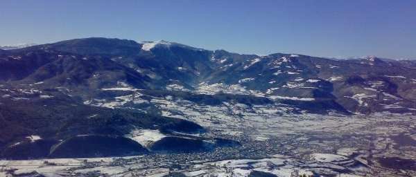
The climate of Gornji Vakuf - Uskoplje is moderate – continental, with extremely cold and long winters and short and warm summers. Within the high altitude areas climate transforms from the moderate - continental to typical mountainous climate, with long lasting snow cover. Geographical position, favourable climate, and large areas of pasture with stated altitudes are all suitable for development of agriculture, especially vegetable farming, livestock and healthy food production, as well as development of winter and mountain tourism. According to the 1991 census, Gornji Vakuf - Uskoplje used to have 25,181 inhabitants, settling the 50 settlements, organized in 15 local communities. Unfortunately, some of these settlements are completely abandoned today, and according to the 2013 population census, the municipality is populated with 20,933 inhabitants. Technical data 
Water supply The urban zone of Gornji Vakuf - Uskoplje is currently being supplied with water from the springs Crna Vrila and Kruščica using the city reservoir of Zvizde with the volume of V = 2000 m3. Capacity of the reservoir and available water resources do not always allow for regular supply of urban areas. One part of suburbs is being supplied from the municipal public water supply system while the other part has got a separate one. Main problems in the municipal water supply are caused by the outdated and inadequate capacity water supply network. The city network mostly consists of various profiles AC pipes having high level of losses. Distribution network is made of various materials pipelines some of which have been installed only recently. The extensions made on the secondary water supply network have been mainly following local population needs. It is estimated that certain part of the secondary network will be connected to the primary water supply network which is planned for construction in near future. 
Sewerage network Along with topographic characteristics of terrain and close vicinity of Vrbas, through several outflow points and integrated segments of existing collectors, main recipient of the previously constructed sewerage system was the river bed of Vrbas itself. Adding the fact that both waste and precipitation waters are being drained into Vrbas through the city sewerage system it can be considered as the one providing for direct and quick drainage of municipal waste and precipitation waters. Considering the overall existing situation it can be concluded that municipal waste waters are not adequately and properly addressed. It should be emphasized that envisaged separation of precipitation and wastewater is necessary for the current state of municipal sewerage system. Following the actual situation and municipal needs, designing of the new city zone storm water and sewerage networks have been initiated including a separate type of sewerage. 
Municipal Scheme Data (on-going and planned construction works) Main purpose of municipal Scheme “Reconstruction of Water Supply System and Sewage System of Urban Part of Municipality Gornji Vakuf – Uskoplje“ primarily reflects in the efforts for improvement of public health situation within the municipality of Gornji Vakuf-Uskoplje, quality of surface waters and underground water sources, as well as the environmental quality in general, all through improved water supply and reconstruction of existing network. Existing water and sewage networks have been following needs of the previous planning period, but due to more recent needs, durability of installations (AC and concrete pipes) requires some new infrastructure investments. The proposed Scheme envisages improvement of services provided to municipal citizens through public utility companies in the field of water supply and waste water collection, reduced negative impact on public health situation, reduced pollution of municipal watercourses, improved quality of watercourses and aquatic conditions of receiving bodies/recipients. Reconstruction of existing water supply network in urban part of the municipality will ensure continuous supply of better quality drinking water without unnecessary losses and easier system maintenance. Reconstruction of existing sewerage network in urban part of the municipality will prevent frequent damages within the system and overflowing of waste waters into public surfaces, which will eliminate risks to human health and environmental pollution and enable easier and more economical maintenance of the system. |